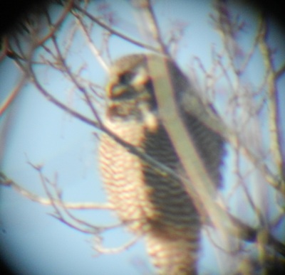
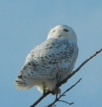
Ah, winter birding in Vermont! Take away the leaves and the warblers, and there's quite a bit to see. And we're close enough to the Canadian boreal forest that we get some wonderful winter visitors. Snow Geese start the season off with their fall migration, making a stop-over in the town of Addison, which is dominated by wide open farm fields. Over the course of the season, one can expect to see Iceland, Glaucous, and Little Gulls, Bohemian Waxwings, Gray Jays and Crossbills, the occasional Boreal Chickadee, and a nice suite of raptors. Snowy Owls are relatively common and always attention-getters, with 8 ringing in the New Year in Addison. Last year there was a Great Gray Owl in Hanover NH. Rough-legged Hawks can frequently be seen around fields and marshes. And for the only the second time in my birding life, I had the privilege today of viewing a Northern Hawk-Owl.
0 Comments
I get a great deal of pleasure hiking up in the Northeast Kingdom, especially in winter. Wilderness still exists there, but it's a slightly tamed wilderness; you're never too far from a snowmobile trail or road, but you can be very much on your own with nature. Essex is Vermont's largest county, but also its least populated; many towns only host one village in 36 square miles. The Canadian boreal forest comes southward here, creating an intermingling of boreal woodlands and bogs amongst the low mountains.
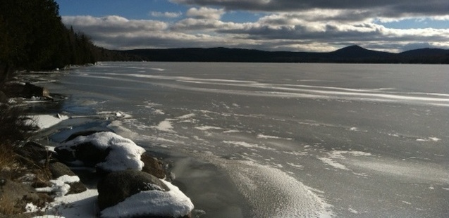
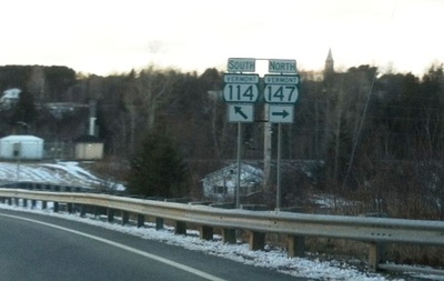
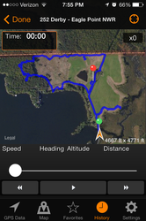
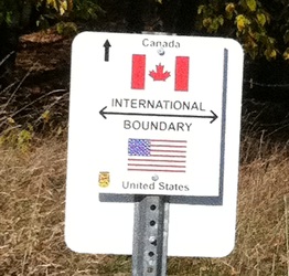
The Kingdom comes alive in wintertime: logging, ice fishing, and of course snowmobiling. There's a VAST trail right into downtown Island Pond, ; cars often have to wait their turn behind Skidoo's and Arctic Cats at the Mobil station. The Vermont Association of Snow Travelers maintains an extensive network of groomed and well-signed trails throughout the region, and these make great trails for accessing the backwoods. What I love most of all -- the ghostly echoes of the snowmobile engines whining from across the valley. The sound from afar is very non-mechanical, and ebbs and flows just like a howling wind, but on a calm bright winter's day. the only northern (boreal) birds observed this afternoon were a Northern Goshawk that flew right over my car, and a pair of Gray Jays. The region is also the place to find many of the other Canadian species in Vermont: Northern Hawk-Owls and Great Gray Owls, Rough-legged Hawks, Boreal Chickadees, White-winged Crossbills, Snow Buntings, Horned Larks. Unfortunately none were seen today. Fortunately, I like exploring this wilderness area! CHECKLIST FOR BRUNSWICK & BLOOMFIELD: Black-capped chickadee, Blue jay, Gray jay, Northern goshawk, White-breasted nuthatch, Red-breasted nuthatch, Golden-crowned kinglet, Barred owl. If you have ever travelled up to Canada from Vermont, and taken the interstate from Burlington towards Montreal, you've noticed that the Green Mountains drop away at the border. But if you travel to Canada towards Sherbrooke instead, you'll see that the mountains are your companion... all the way up into the Gaspe of Quebec. The northeastern corner of Vermont's "Northeast Kingdom" - aka Essex County - is a small wedge of the state between Quebec and New Hampshire. Follow VT-114 due north out of Island Pond, and when that highway gets to the border, it does a right-hand turn to the east; no sense giving that last stretch of highway a separate route number, eh? At that right angle is the junction with Vermont's shortest state highway: VT-147; it connects to QC-147 and is so short, I could throw a frisbee to the customs agents on the US side, roughly the distance to my across-the-street neighbor's house. Saturday was cold and blustery, but partly sunny. Dressed properly, it was a wonderful day for winter hiking. The birding was minimal, but I found a couple of hiking trails that took me up into the woods, and away from the highway. I was never more than a mile from the border, which always adds an element of heightened awareness and anticipation for me; the border is not just a line on the map, it's a real thing you can see and touch... just don't cross! Norton runs along the border for several miles, with Canaan continuing the frontier into that tiny nook where Vermont, New Hampshire, and Quebec meet at a bend in the river; Averill is a diamond-shaped town that meets the two towns at its apex, but is the only one with a significant body of water: Averill Lake. I found a nice side road that hosts camps along the western edge, so that was my longest walk. Towards its north end, there was a hiking trail which climbed the hill and then looped back down to the road further north. I was totally alone, but the tracks told me the area was busy with deer, chipmunks, rabbits, grouse, and a fox; as you can hint from my checklists, the most common sounds were those of chickadees and the wind. Checklist for Averill: Common Raven, Black-caped Chickadee, Blue Jay, Grouse tracks (Ruffed or Spruce) Checklist for Norton: Common Raven, Black-caped Chickadee, Blue Jay, Grouse tracks Checklist for Canaan: Mourning Dove, Black-caped Chickadee, Blue Jay I've been hiking the Lamoille Valley Rail Trail, across northern Vermont, to accomplish two goals concurrently: to bird in more of the northern towns, and to verify which sections of the LVRT are open and accessible. The late autumn weather can be thoroughly enjoyable for hiking, with few insects, dry air, and no leaves on the trees to obscure one's view (yes, there are advantages to the leaf-off seasons!). I started at Joe's Pond, in the nice little lake community of West Danville; the pond is a nice small lake with an intricate shoreline and several small islands. Joe's Pond is purportedly "the largest body of water called a 'pond' in Vermont". I guess every town needs a claim to fame. The trailhead parking is directly across from a very interesting old general store; you walk in the door, and face the junction of the store, bakery, post office corner, and living quarters access. Which way to turn??? The LVRT follows the northeastern shore of Joe's Pond, and then turns westward and heads into Walden. There are some nice lakefront houses and cabins along the trail, and some very lovely views of the lake and surrounding mountains. Once you cross into Walden, you are in predominantly spruce forest without much sense of civilization. The rail trail has long straight sections west of West Danville, which contrasts greatly with the undulating northward and southward bends of the line as it climbs out of Danville Center. The highlight of this trip -- before I got shot at -- came as I approached a swampy section of woodland. I noticed what I thought was a squirrel in the brush, nervously chitting at me and flicking its tail to warn me away. I'd stopped for a snack and juice break, and hadn't given the squirrel any consideration. But then it occurred to me that the deep woods was an odd place for a squirrel, since there are no oaks or beeches here. When I brought my binocs up to my eyes, I discovered that it was not a squirrel annoyed by my presence, but rather a Spruce Grouse... or more precisely, a pair of Spruce Grouse! I've been in Spruce Grouse habitat many times before, and I know them from their photos on the posters mounted by the Fish and Wildlife Service (there's a $500 fine for shooting one, in Vermont), but I'd never actually seen one. And here were two! Of course they both flew off into the woods as soon as I got my camera powered up and turned to take their photograph. Ah, but what a thrill. After the grouses, I continued for another mile or so along the trail. I was just approaching one road crossing and was using my binocs to see what the sign another quarter mile or so was alerting me to, when BANG!! BANG!! BANG!!! Jeeze!!! That was close! But fortunately I was not actually being shot at... the hunter was target practicing on the other side of the railroad berm. Nonetheless, that was enough for me, and I did an about face and decided now was a good time to start the 4 mile hike back to my car! CHECKLIST FOR WALDEN: Spruce Grouse Black-capped Chickadee Red-breasted Nuthatch American Goldfinch Pine Siskin American Crow Common Raven Eagle Point Wildlife Management Area preserves a sliver of land between Lake Memphremagog, John's River, and the Canadian border. When I saw this in my atlas, it struck me as a unique place to bird... and I was not disappointed. Not only was the birding very nice, but there was the additional exhilaration of hiking along the international boundary between the USA and Canada. I deal with the border regularly as part of my work, but having a trail that follows the border was very cool.
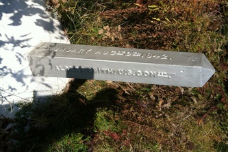
The monuments state that "BOUNDARY AUGst 9th 1842" / "ALBERT SMITH, U.S. COMssr" I was curious to see what sign was mounted on the Canadian side of the border signs, but not wanting to cross the border and risk undue consequences, I reached my iPhone across and took a 'selfie'... it's a National Wildlife Refuge boundary sign! I would definitely come back to Eagle Point, to hike the trail again, and to paddle my kayak in the lake. Just offshore lies Eagle Island, and while I didn't see any eagles, the rocky shore was hosting massed flocks of geese, ducks, and cormorants. CHECKLIST FOR EAGLE POINT, DERBY: Canada Goose Wood Duck Mallard Hooded Merganser Common Loon Double-crested Cormorant Turkey Vulture Northern Harrier Ring-billed Gull Belted Kingfisher Hairy Woodpecker Downy Woodpecker Blue Jay Common Raven Black-capped Chickadee White-breasted Nuthatch Golden-crowned Kinglet Chipping Sparrow Song Sparrow American Goldfinch After the disappointment of Windham, I set my sights on a deep-woods location in the town of Weston. There was a National Forest Route from VT-100 right up to the vicinity of Moses Pond. I still wanted to discover more of the bird species that can be found in the deep woods in a Vermont summer.
Forest Route 17 took me up a hard-pack road up towards Moses Pond, but the road did not actually go up to the pond... it stopped a mile short. Fortunately, there was a trailhead parking area, so once I had applied bug spray, packed up my water, binocs, camera, and iPhone, I trekked up towards the pond. The mosquitoes were relentless, despite my heavy application of bug spray; I kept hiking because there was no way to stop and focus my attention on a bird in the woods because of the attacks. I birded mostly by ear, knowing that at the higher, cooler elevations the mosquito attacks should abate. Finally the trail comes within view of Moses Pond, and my feelings lift. Moses Pond is almost uninhabited; I could see one canoe on shore at the eastern end, but there were no camps or clearings. Just moss-covered tree stumps, and the enclosing hemlocks. Once I spied a relatively easy route thru the woods to the shore, I left the trail and headed downhill. I found a small fringe of hemlock that protruded out into the pond, which struck me as the perfect place to settle down and enjoy the setting. The ground was soft with thick sphagnum moss, with sedges and a few low-bush blueberries. I relaxed against the outermost tree, enjoyed a snack, and just listened. Paradise! Dragonflies and Tree Swallows skirted over the water, while a family of Wood Duck paddled along the far edge of a pad of water lilies. Chickadees were still calling in the woods behind me, and a Ruby-crowned kinglet was singing from high in a hemlock nearby. This tranquil setting and soundscape was twice pierced by the call of a Barred Owl, far up on the hill opposite me. "Who cooks for you? Who cooks for you all?" The call echoed off of unseen hills. Eventually it was time to move on. I decided to hug the shore for a bit, then return to the trail and trek onward. Just a short distance from where I'd spent the last half-hour resting, I spied a few small, thin growths with staggered leaves, rising from the sphagnum at the water's edge. Orchids! Oh, I immediately got down on my knees and elbows to examine these dainty little green flowers, just 6 inches above the moss. I knew immediately that this was an orchid species I had not seen before. I spent a few minutes photographing and committing the flower structures to memory, so I could look it up in my reference books back home. Platanthera clavellata. Apple green flowers on green stalks, a small lobed lip, lateral sepals held upward -- as opposed to downward with most other Platanthera species. My 18th orchid species observed in Vermont! Back on the trail, I continued to the west end of Moses Pond, which is where I found its outlet There was a series of little beaver dams, creating a chain of small ponds. The trail crosses the chain of ponds on a wooden snowmobile bridge; the beavers had commandeered the bridge and had built one of their dams under, into, and onto the bridge, causing the bridge to start to tilt under the increased pressure. One good thing about these little ponds was that they provided a view towards the west; dark clouds had been building, and I could see they were moving in my direction. I didn't want to hike one and a quarter miles back in the rain, then have a 2 hour drive home, damp, so I made an about-face and started my way back to the car. As I descended towards the trailhead, I could feel the air freshening and the breeze increasing as air was sucked into the bottom of the storm... a thunderstorm was closing in on me. I made it back to the car, and was actually about 1/4 mile down the road when the rains caught up with me. Sometimes life really is a ra Recalled checklist for Weston: Wood duck Golden-crowned Kinglet Ruby-crowned Kinglet Black-capped Chickadee Tree Swallow Blue Jay Common Raven Barred Owl Ovenbird Common Yellowthroat Hermit Thrush One of the surprising stops on my Lost Marathon Weekend was my trek up Corn Hill Road, out of the village of Windham. I was hoping to get high up onto Glebe Mountain from this road out of the village, but to my dismay, the road only went for one block before being blocked by a tree trunk across the road... Corn Hill Road becomes a logging trail at that point. After making notes for updates to our TomTom data, I grabbed my water bottle and gear, and started up the logging road. It was a humid, buggy trek, but there was a pleasing variety of butterflies along the scar thru the woods. Skippers, a pair of fritillaries, and then a flock of over 20 Wood Nymphs who were feeding at the shallow remnant of a storm puddle.
Just 7/10ths of a mile up the trail, the land was gated. "Private Land / No Trespassing". There would be no trek up onto the ridge of Glebe Mountain from Windham. As I neared my car, I passed thru a logged lot, which still had several brush piles but also had a heavy growth of understory plants, shrubs and the next generation of trees. From one nearby brush pile, just off to my left, I heard a harsh, repeated, and plaintive call. Soon that call was answered by a long warbling song, rising and falling, with fluted trills as well as warbles... A Winter Wren had arrived to feed its hungry fledgeling chick. I was able to get nice photos of both of these wrens, before I was distracted by another unusual song from over my left shoulder. It took quite a while of watching before the singer became visible in the undergrowth. The yellow breast and gray head were evident, then as the bird jumped to another branch to get a better view of me and my intentions, I could see a black neck, black eyes, and an olive back. A Mourning Warbler! My first ever seen. After the emotional rise of seeing a new species -- and a distinctly colorful one at that - I kept my binocs on the moving song as it moved closer. Eventually the warbler took up its perch atop the same brush pile where the winter wrens had been. I wonder if the draw to that brush pile was the tree with a low branch immediately adjacent to the pile. A safe escape readily at hand Recalled checklist for Windham: American Robin Winter Wren Mourning Warbler Blue Jay Common Yellowthroat Pileated Woodpecker and butterflies: Common Wood Nymph Aphrodite Fritillary Skipper (unkn species) Oh, man!! I had had a very successful long weekend -- surveying over a dozen southern Vermont towns in 4 days -- and yesterday I discovered that the last town in my iPhone's NOTES app was #132 Groton. NOOOOO!!!
Glastenbury, Shaftsbury, Bennington, Pownal; Ludlow, Chester, Andover, Londonderry, Jamaica, Townshend, Windham, Weston, and Wardsboro; Rupert and Dorset, Proctor; Montpelier, Waterbury, and Williamstown. All lost, and all full-day birding expeditions. I averaged 150-200 miles a day that weekend. Apple suggests trying to restore my last backup from iTunes, but I'm not optimistic. I know that the map I keep, the photos I took, and the memories I still have will give me some recall, but the scientific value of that weekend is mostly lost. Many of these towns will have to be re-surveyed, I'm sure. Glastenbury, Weston, and Windham have strong memories, but the others... not so much. What a loss! Mention to most people that you spent the day birding, and they will ask 'What birds did you see?" When you go birding along VT73 thru the Brandon Swamp, and the birding is not about what you see but what you hear. Herons, rails, wrens, owls... all heard but unseen. Today I came away with 4 recordings of birds I could not see and did not recognize immediately -- Two of those recordings were of birds that were probably within 12 feet of the road edge. I'll need to compare my recordings to Peterson's guide to Bird Songs and to my iBird Pro recordings, to see if I can make concrete identifications.
Initial Checklist for Sudbury: Mallard Virginia Rail (both male and female calls) Marsh Wren Belted Kingfisher Willow Flycatcher Warbling Vireo White-breasted Nuthatch American Robin Mourning Dove Gray Catbird Common Yellowthroat Yellow Warbler Yellow-rumped Warbler Red-winged Blackbird Common Grackle Swamp Sparrow American Goldfinch Unknown #1 Unknown #2 Unknown #3 Unknown #4 Cornwall lies in the lowlands of the Otter (Creek) Valley, north of Brandon and Sudbury, and when the rains are as heavy and incessant as they have been this summer, the valley floods. As I drove from Brandon to Sudbury, the level of the Otter was only 2-3 feet below the highway, but when I came back across thru the Cornwall Swamp WMA, the water was within inches of the road, which formed a dam to the floodwaters. Fortunately for the road, the water level was just as high downstream as upstream, so the road was not being eroded... just topped. This setting made for a fascinating and very enjoyable birding session. For almost a mile I walked thru a flooded forest, with dark, tannin-stained waters flowing on either side of the 'causeway'. I was taken aback by the Northern Waterthrushes, which I rarely hear; they made me think I was in a tropical environment rather than in Vermont. At the far end of the flooded forest, the setting changed, and the roadway was flanked by flooded fields and then a covered bridge crossed the swollen creek. Beyond the bridge, there were still more flooded fields. The wildlife was very active. Birds and frogs, a snakes and a rabbit kept my senses at their max. There were no herons to be found, but I could hear two Wilson's Snipes winnowing over the flooded fields, a Virginia Rail oinked at one point, and a Great-crested Flycatcher added to the mix. Can't wait to go back and spend a few hours there! Checklist for Cornwall Swamp WMA: Wood duck Red-eyed Vireo Killdeer Virginia Rail Wilson's Snipe Great-crested Flycatcher Eastern Wood Pee-wee Barn Swallow Northern Flicker White-breasted Nuthatch Common Yellowthroat American Robin Veery Gray Catbird Northern Waterthrush Bob-o-link Red-winged Blackbird |
AuthorI've been a life-long 'naturalist' -- interested in every aspect of the natural world. I began birding in the early 1990s, and have been a serious birder for over two decades. Archives
March 2021
Categories |
| Bob Heitzman -- The 251 Town Birder |
|
 RSS Feed
