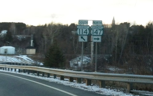
If you have ever travelled up to Canada from Vermont, and taken the interstate from Burlington towards Montreal, you've noticed that the Green Mountains drop away at the border. But if you travel to Canada towards Sherbrooke instead, you'll see that the mountains are your companion... all the way up into the Gaspe of Quebec. The northeastern corner of Vermont's "Northeast Kingdom" - aka Essex County - is a small wedge of the state between Quebec and New Hampshire. Follow VT-114 due north out of Island Pond, and when that highway gets to the border, it does a right-hand turn to the east; no sense giving that last stretch of highway a separate route number, eh? At that right angle is the junction with Vermont's shortest state highway: VT-147; it connects to QC-147 and is so short, I could throw a frisbee to the customs agents on the US side, roughly the distance to my across-the-street neighbor's house.
Saturday was cold and blustery, but partly sunny. Dressed properly, it was a wonderful day for winter hiking. The birding was minimal, but I found a couple of hiking trails that took me up into the woods, and away from the highway. I was never more than a mile from the border, which always adds an element of heightened awareness and anticipation for me; the border is not just a line on the map, it's a real thing you can see and touch... just don't cross!
Norton runs along the border for several miles, with Canaan continuing the frontier into that tiny nook where Vermont, New Hampshire, and Quebec meet at a bend in the river; Averill is a diamond-shaped town that meets the two towns at its apex, but is the only one with a significant body of water: Averill Lake. I found a nice side road that hosts camps along the western edge, so that was my longest walk. Towards its north end, there was a hiking trail which climbed the hill and then looped back down to the road further north. I was totally alone, but the tracks told me the area was busy with deer, chipmunks, rabbits, grouse, and a fox; as you can hint from my checklists, the most common sounds were those of chickadees and the wind.
Checklist for Averill:
Common Raven, Black-caped Chickadee, Blue Jay, Grouse tracks (Ruffed or Spruce)
Checklist for Norton:
Common Raven, Black-caped Chickadee, Blue Jay, Grouse tracks
Checklist for Canaan:
Mourning Dove, Black-caped Chickadee, Blue Jay
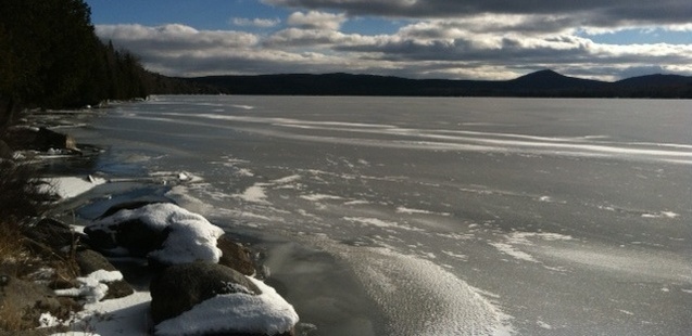
Averill Lake from the state boat landing. The ice was about 2 inches thick, but the winds were still strong enough to push the entire icy crust up onto shore... a bit.
 RSS Feed
